I had a ride under the rain and altitude was badly recorded, so I used the Elevation Correction setting in Garmin Connect activity page, same I did in Strava.
Since the activity was imported in Intervals with wrong elevation, how do I reload the activity with corrected elevation? Is it even possible?
somehow i do not believe that this can be done. I’ve not checked it myself, but the elevation correction setting only changes the data within Strava / GC itself but not the FIT file.
I may be totally off the mark here, so you can give it a go by downloading the FIT file manually and uploading it here manually.
Alternative is to just use Intervals.icu’s elevation correction feature instead.
can you share some screenshots of that?
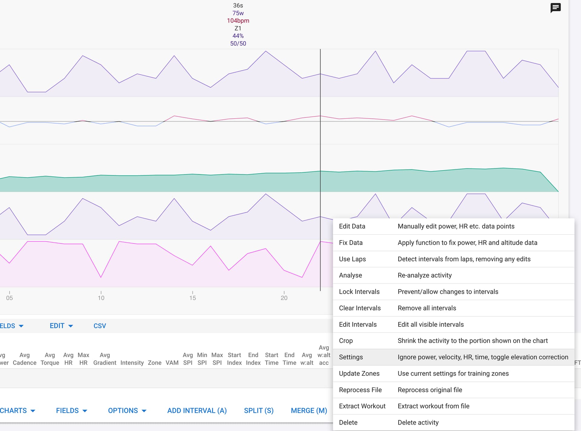
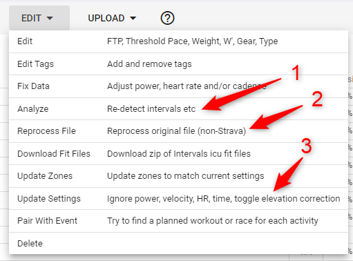
oh.. and I’m not entirely sure if you need to do a “Analyze - Reanalyze Activity” or a “Reprocess File” to get Intervals to ensure it’s using the new setting. Do that if you have not.
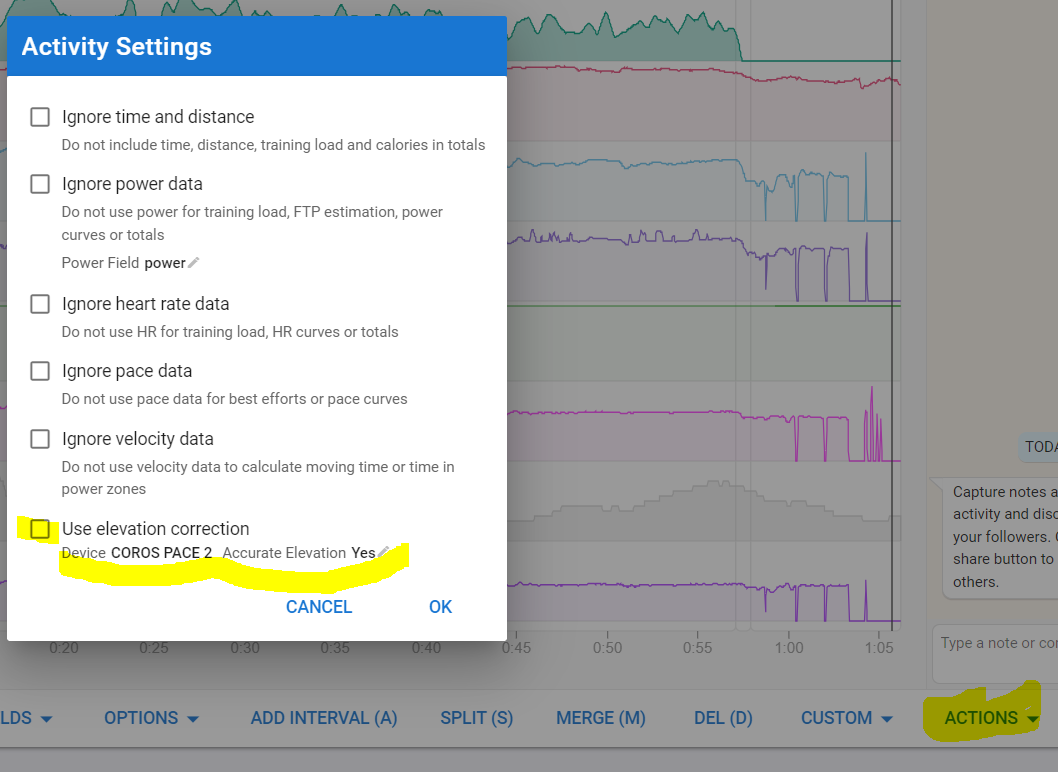
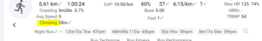
open the activity page and check the ‘climbing’ metric. Make a note of it.
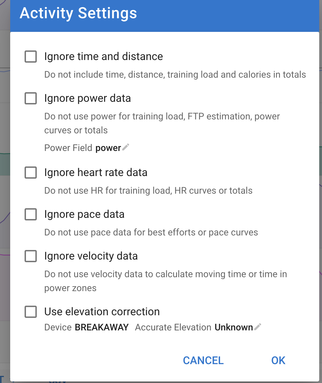
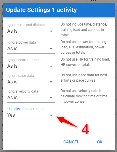
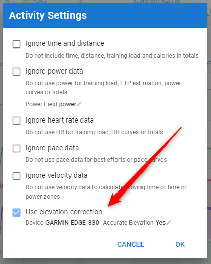
go to bottom of the activity page, Actions, Settings and toggle the Use Elevation Correction
You should see that Intervals recalculates elevation and returns another number as the climbing metric.
If not, your recording device may be noted as not having correct elevation and elevation has already been corrected.
I used elevation correction in GC and it worked. Also in Strava, it got the correct elevation without asking. Recorder .fit file has ~1400 mm, in reality I climber ~3000… funny day out
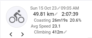
Strange, I would at least expect to get a different climbing metric as in my case:
Before:
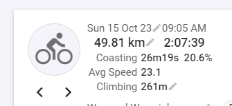
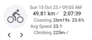
After turning on elevation correction:
BTW: Garmin Edge 840
And another number when I turn off elevation correction again
Elevation/climbing is always a difficult topic. The explanation for the above is:
If your device provides a Climbing field, written in the FIT file, Intervals will use that field based on the climbing algorithm used by your device. If that field is not available in the FIT file, Intervals will calculate climbing from the elevation stream in your FIT file
If you let Intervals correct elevation, the result is based on the elevation found in online maps for the GPS coordinates in the fit file
If you unselect the correction, Intervals will use its own algorithm to calculate climbing from the elevation points in your FIT file
The differences in all those calculations are the result of differences in the algorithms. What will be considered an elevation change? 1m up and then 1m down again, will be counted by algorithms that have a trigger point lower then 1m. It will not be counted by algorithms with a trigger point at 1.5m.
That’s why sometimes you see big differences in comparing different units, apps… That’s more pronounced when riding rolling terrain. On one big climb, the results of all units will be much closer.
can you try it out w/ any other activity files using the same device and see if there is a change in the elevation?
I’m thinking that it’s possible it’s due to this device either not in the Intervals.icu database or something is happening behind the scenes which will need @david to look at
Edge 830 is in the database for sure and I know by experience that it has quite accurate elevation. Haven’t seen any meaningful change since I replaced my 830 by an 840.
Yes, I do get 2 very different numbers for “Climbing” when I toggle “Use elevation correction” on and off, but nothing happens to the Altitude and VAM graphs. Only Gradient graph changes a lot.
VAM is calculated over a longer interval and not point by point. That’s why VAM results will be very similar.
Gradient is again on very short sections, so the fact that the algorithm considers the change as valid or not, plays again a big role.
The worst result is when you have your barometric sensor jumping up and down just above the algorithms trigger point. You will get a lot of climbing meters that are not valid. That is something you see when riding in bad weather conditions. The atmosphere is less stable and causes confusion for the sensor.