Very interesting, thank you.
Regarding altitude graph: There are different charts for “original” and corrected altitude. As far as I understand, the default graph is showing altitude information recorded by the device. To show corrected altitude, click “CHARTS” at the bottom, search for “altitude” and select “Fixed Alt” chart.
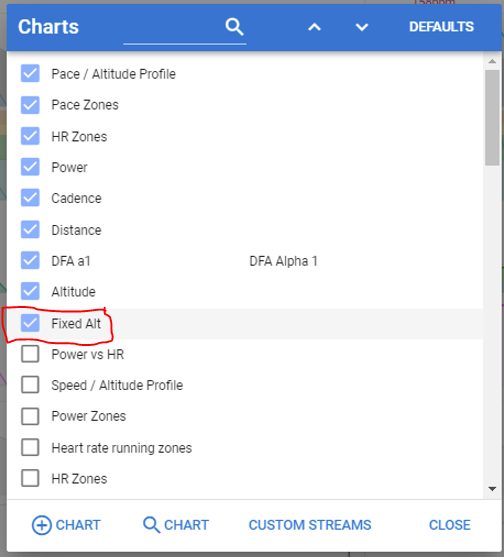
This should give you an additional graph for the corrected altitude values suggested by Intervals.icu based on online maps.
3 Likes
Yes, it works! Thank you!
this means it’s solved? The elevation correction did work?
1 Like
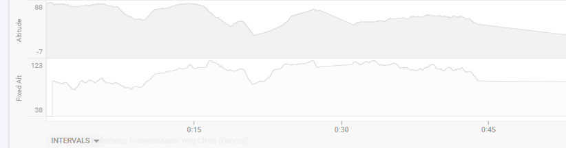
It means the Elevation Correction changed the total climbing number, and shows a decent altitude graph in Fix Alt (didn’t even know it existed… my fault). By the way, Gradient and VAM graphs didn’t actually change - also interval values - so it’s quite useless for my analysing purposes…
Glad half full… ![]()
The Fixed Alt is based on Topo maps or GPS coordinates data from surveys and such. Those numbers would be different from your Barometer readings in an actual device (which also could be influenced by weather during that day)
What was the elevation in GC and in Strava after the correction vs the corrected elevation in Intervals?
actual FIT file shows 1400m but you said you climbed 3000m. Strava and GC shows 3000m?
Yes, they do. Also Intervals does, slightly different (~3800 m) but I suppose it’s a matter of different data pools. Btw, Gradient and VAM are not calculated on corrected altitude but on the original data.