I asked the question to make it easier to understand, not for me, but the forum in general. As you have stated, privacy is important, and there needs to be some guidelines for users to follow, as well as help David implement some safeguards, eg. the post about downloading activities, above.
All my rides on Strava are private by default and I change it to Followers if I feel it’s worth sharing. I also have activities mark private on Garmin Connect and apps like Rouvy and Zwift. I am only interested in letting people I know, or coach, have access to my data (with the exception of a few users on this forum who have shown an interest in learning about rest, recovery and structured workouts).
@david you are awesome!
That’s exactly what I was looking for. Intervals is all I need and even more.
I’m really happy to support your work, as a support because you definitely deserves it!
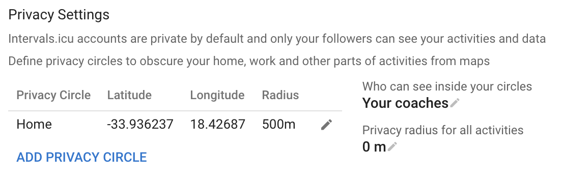
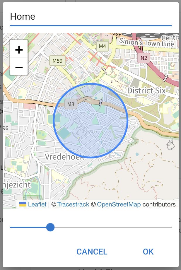
You can add as many as you like. Pan around on the map to move the circle. You can also define a radius around the start/end of all activities that is considered a privacy circle.
GPS data inside a privacy circle is not shown on the map or in the activity streams download. By default your coaches can see inside your privacy circles.
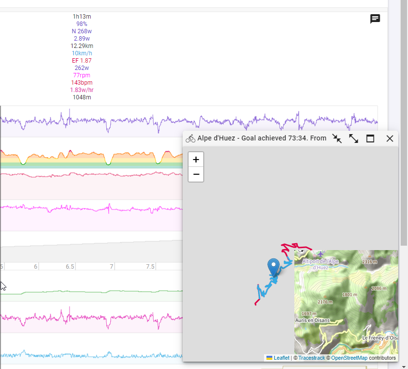
Thank you David, very nice @david . I remember to see option to automatically recenter map on some web. It might be useful, when map is zoomed and only a section of a ride is visible. As you move over the graph, you position on a map is re-centered, so you can always see your position. Not sure how difficult it can be to implement it.
Hi.
The mini map is a really a great feature, so thank you.
Question: the mini map don´t show the places names. Is this normal or am I doing something wrong or lacking something?
David, would it possible to add function to map, that it would move as I hoover over graph, that it is always re-centered to current position? It might be useful, when map is zoomed and only a section of a ride is visible.
Is it just me, or are more people having issues with the higher zoom levels in the mini map? When I zoom out I see the map detail, but when I start to zoom in, I get “grey” area’s, and after some point, I see nothing but grey, and the line where I was riding.
I have the same. Looks like a problem with the tile server for different resolutions.
Worked ok yesterday, so could just be the map provider. Check again tomorrow.
It is fixed now. There was an issue with the Intervals.icu tile server not picking up an IP address change from the provider. The tiles are also cached by your browser which is why some were displayed. Sorry about that.
Would be possible to also switch it on or off on the ‘activity power’ tab? I’d like to see where I did certain max efforts. (boils down to, pls recreate the powercurve page Strava offers, because I like their map there but Intervals’ powercurve is 10x better )


 )
)