Since last Friday, the fixed altitude field has been smoothed (which I think is a good change). However, compared to the original altitude, the profile is shifted to the right, i.e. the peaks on a route appear later on the graph than they were reached in reality (see example below). They are also misaligned with the map.
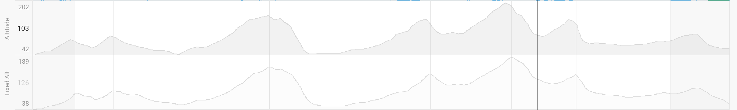
This may be because the moving average window is looking at earlier points when computing the average, rather than being centered. Note that this doesn’t occur when applying a moving average to a custom chart (including altitude), so might be specific to the new fixed altitude smoothing