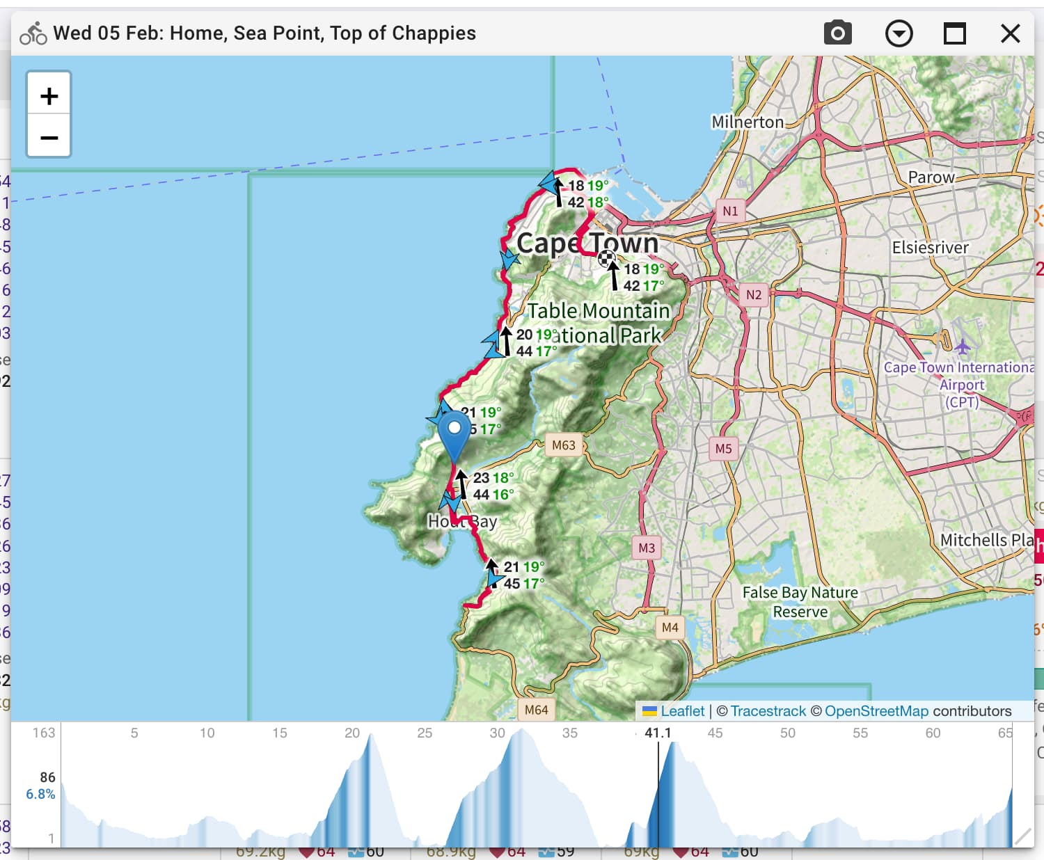
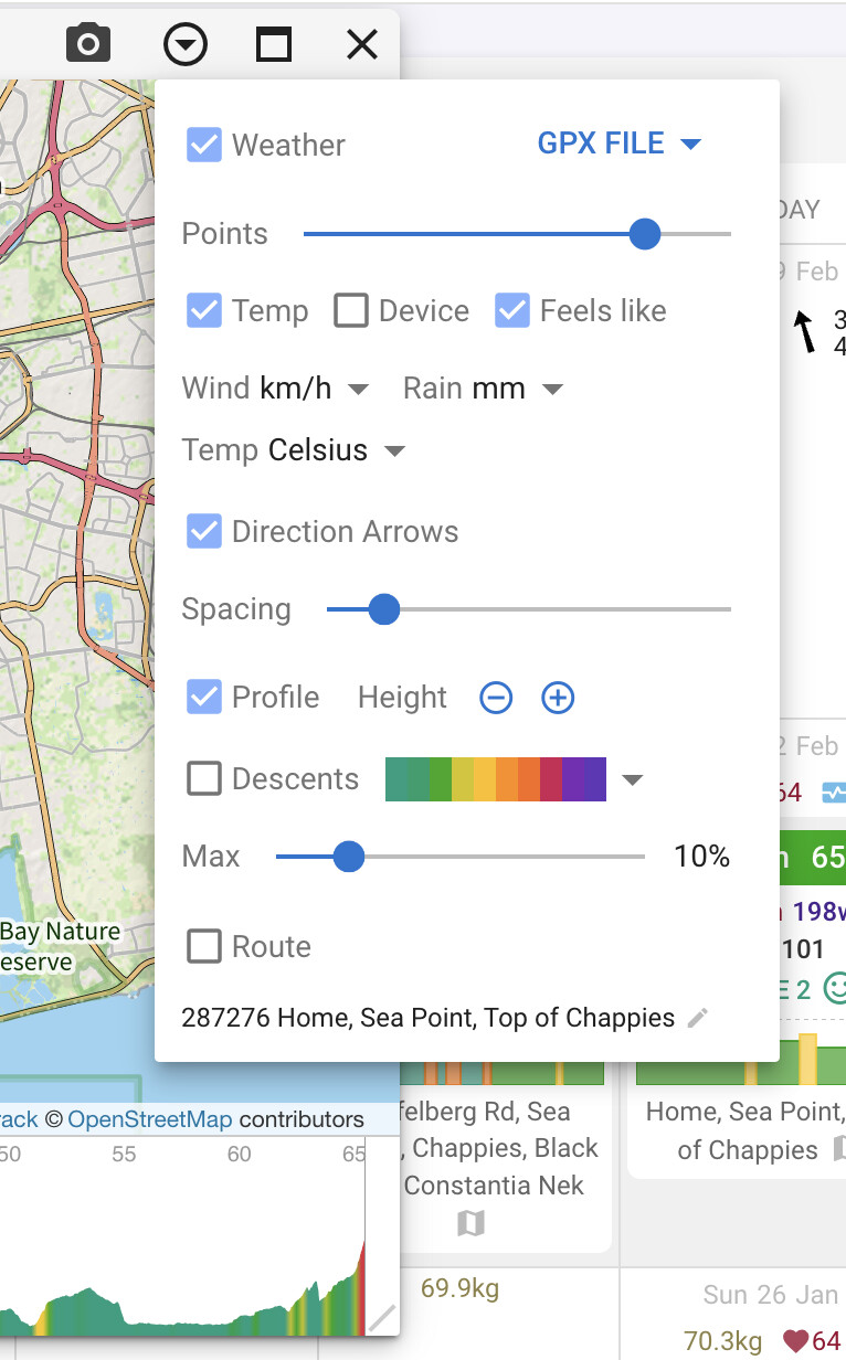
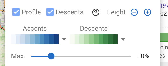
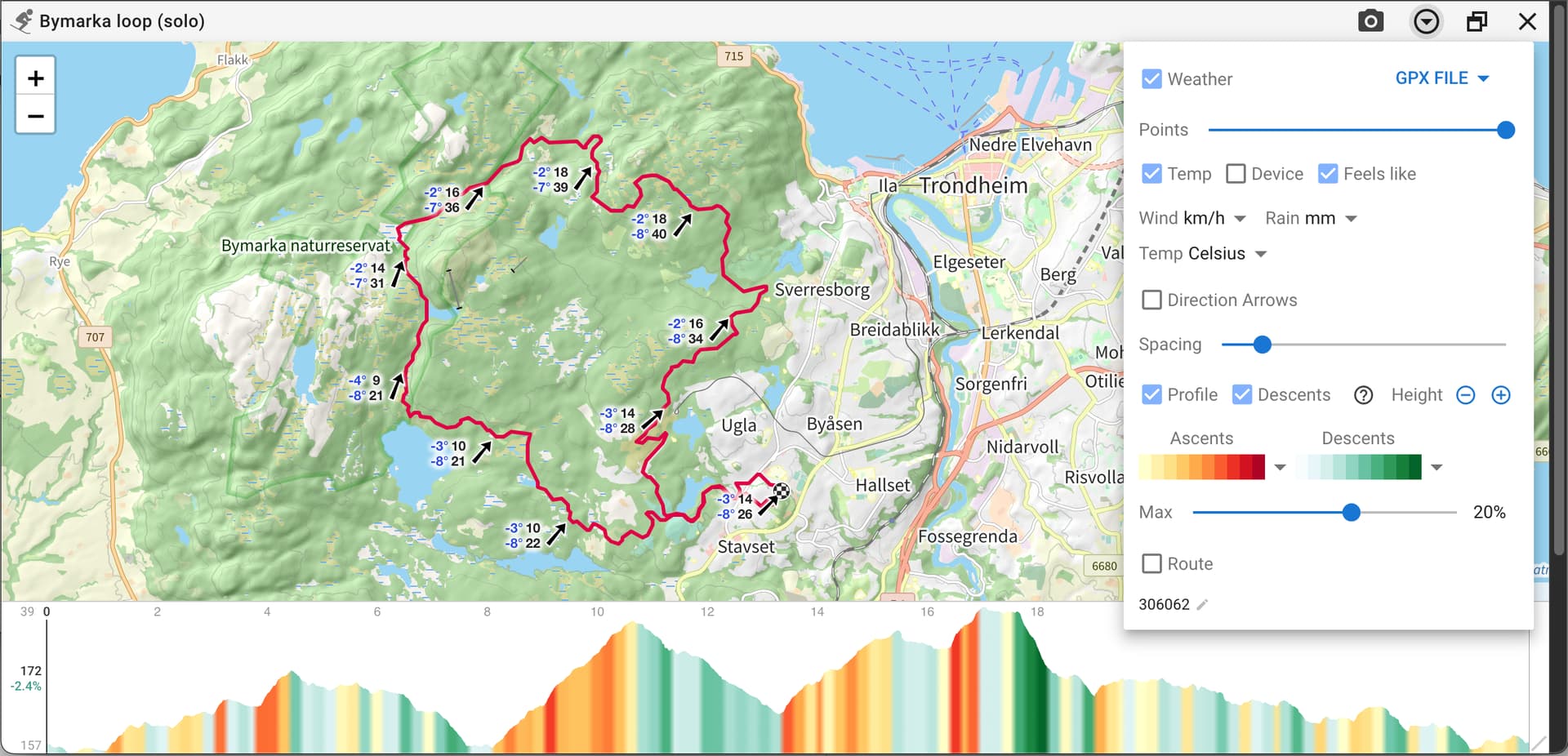
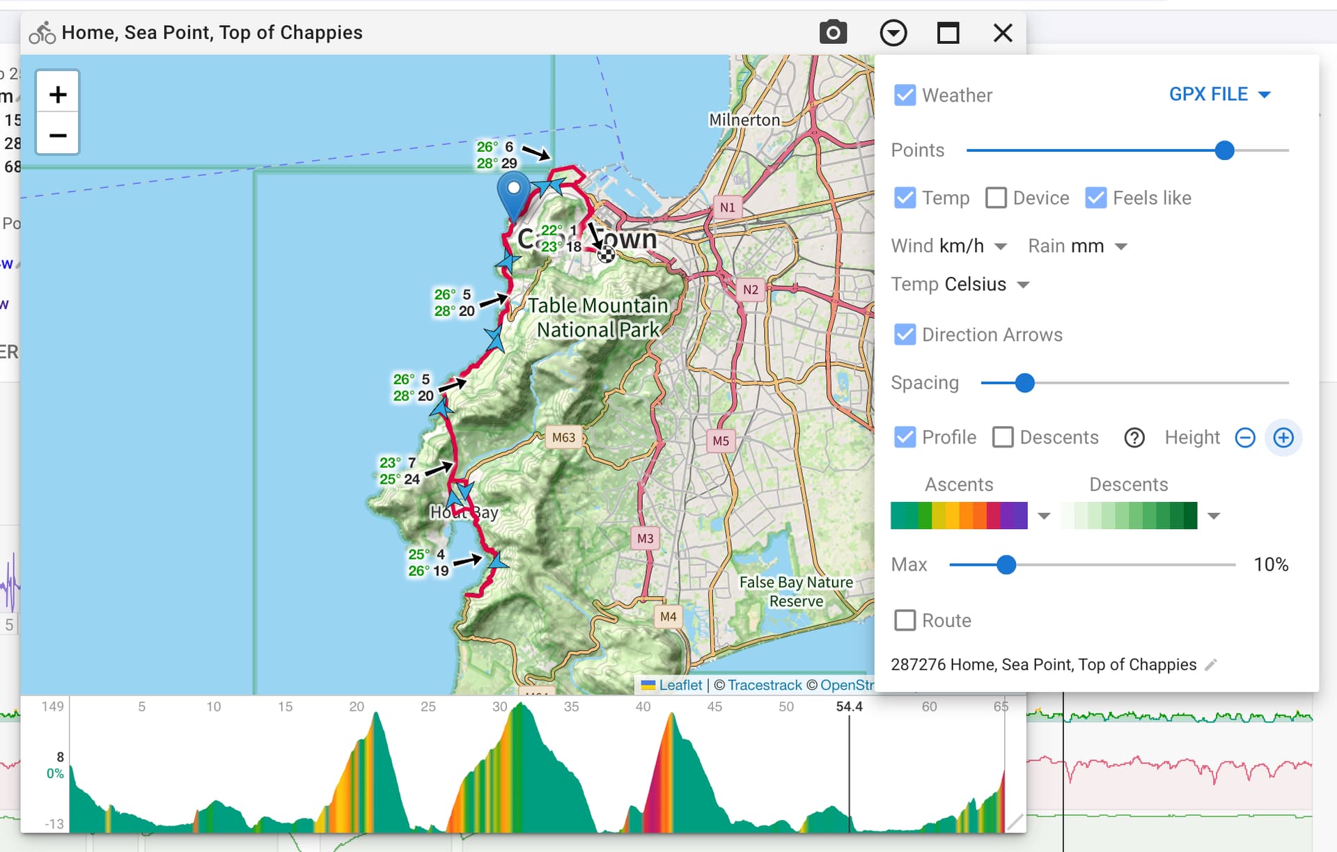
You can choose the colours, show descents or not, max gradient % (where the far right hand side of the scale is). These are all per sport grouping (run, ride, walk, ski etc.):
Well done, I really like having an elevation profile.
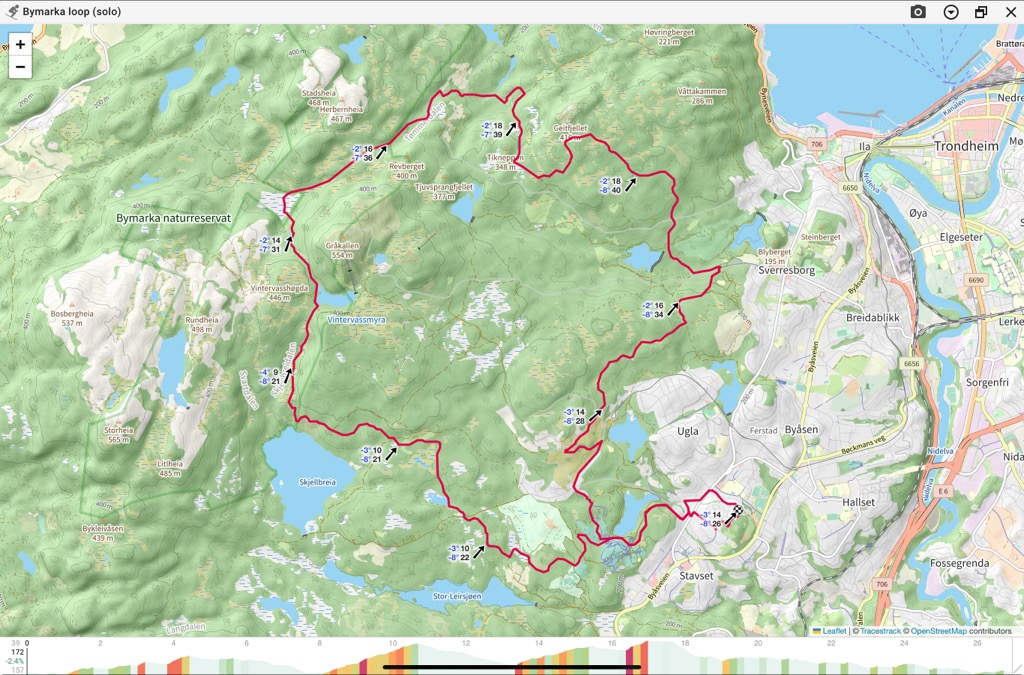
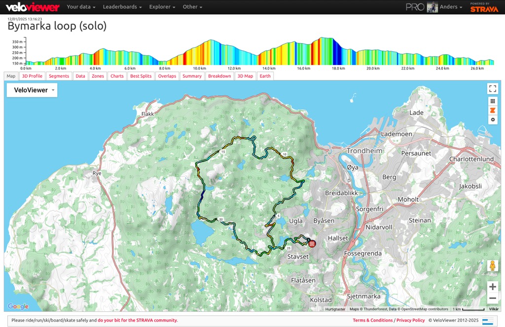
There were plenty of color maps, I still think I prefer the Veloviewer style (maybe just because I’m more used to that one, and it does not «mix up» uphill and downhill). Comparison below.
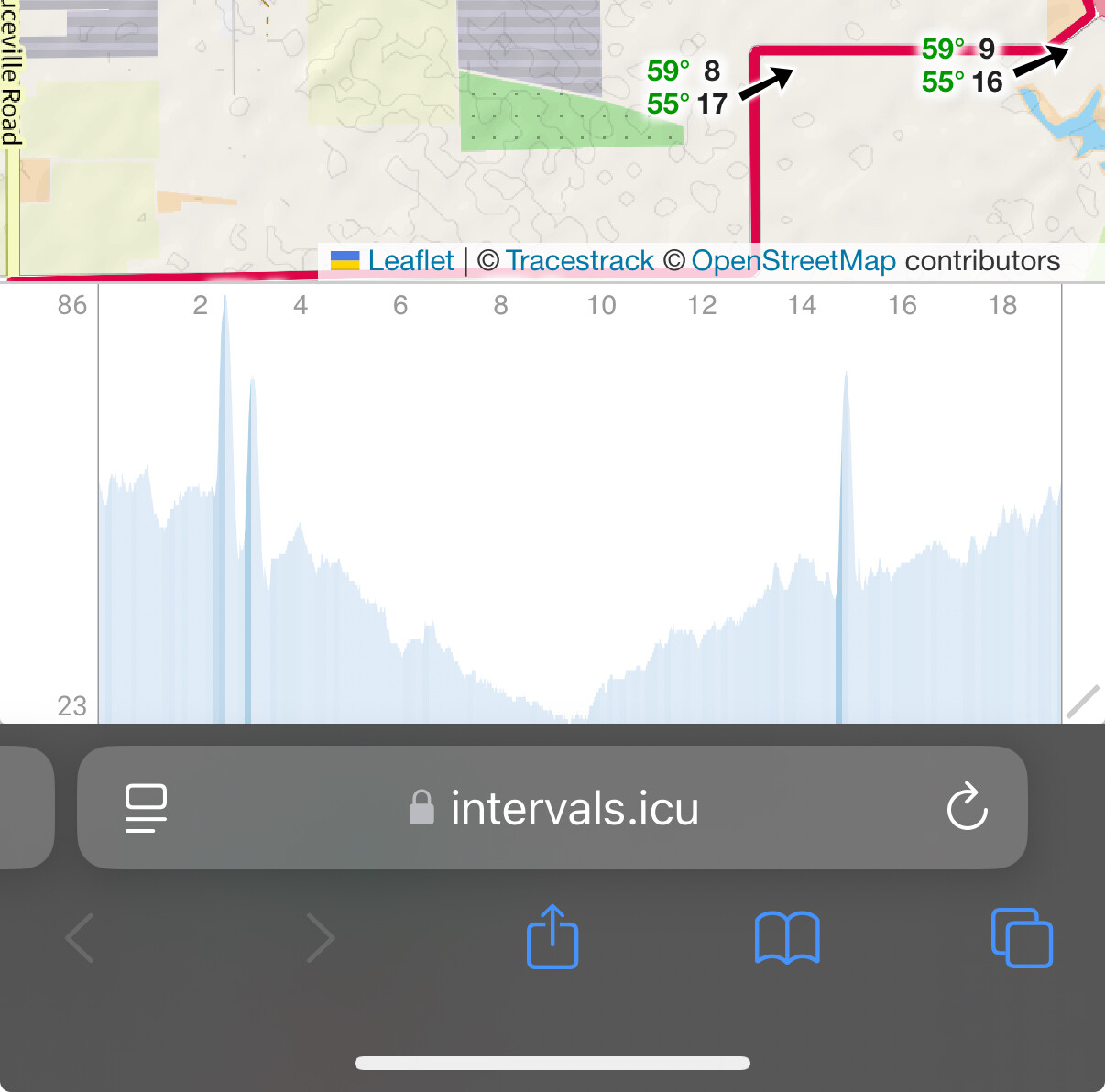
For some reason, it looks like the intervals profile becomes cropped at the bottom (even when I maximise the window). This is on iOS, last version of Chrome. (it is not just my screenshot that cropped it, I also tried playing with the y axis and zooming out in the browser, but the bottom of the chart is always outside the screen or so close to the edge that it looks like it’s cropped. maybe adding an offset would help?)
Annoyingly this happens when Intervals.icu is run as a home screen web app but not if you just visit intervals.icu from Safari. I am trying to figure out a workaround.
I also enjoy the colors now, it helped to have a separate option for the descent!
An even better descent color profile could be light green to blue to dark blue.
Similarly, the ascent color profile could be light yellow to red to dark violet (the opposite of one of the available profiles).
So, basically even darker colors for the serious stuff (both up and down) but without mixing them up.
This is embarasing, I thought I have checked everywhere. Thank you.
If I may, I would like to add a future request. I’m not suggesting you become a route planning service (just yet ), but would it be possible to add an option to import a .gpx file of a planned route to planned activity in calendar and process it there (show on map, show gradient, maybe place planed intervals on a certain part of the route, do time estimates for intervals planned on certain parts of the hills, so we know how much hill do we need to preform intervals at certain power, …)?