A few of my activities are displayed like this:
I have no clue why? Is there sth wrong with the recorded data? Most, I guess all, of them were recorded with Polar watches.
Many thanks
A few of my activities are displayed like this:
I have no clue why? Is there sth wrong with the recorded data? Most, I guess all, of them were recorded with Polar watches.
Many thanks
There can be a few reasons, one of which is that your activity starts before the satellites are fully connected.
To fix it, you can crop the first second or more. Upload to fitfiletools and then use the Section Remover option.
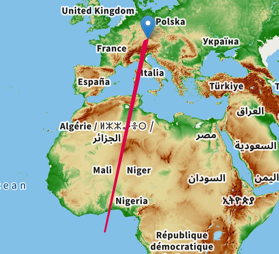
Not really an explanation for why it’s happening to you but the point in the Atlantic is 0 degrees longitude, 0 degrees latitude. Possibly a default 0,0 value used where the software expects valid location data.
Weird.
I verified against
Strava, gets correct rendered,
Polar Flow, renders correct,
GoldenCheetah, renders correct.
Additionally I checked the raw data with GC if longitude, latitude, course and speed etc is correct. And it looks good. Especially the start and end points don´t have the normal issues.
This also happens to me with importing tcx files downloaded from Polar Flow into intervals.icu - they always seem to com through with a Lat 0 Long 0 start point.
Robert
If it’s only the first x GPS points, you should be able to solve that by cropping in Intervals and leaving out a few seconds at the start.
Make a selection leaving out a couple of seconds at the start and then: Activity page - Actions - Crop.
I looks like being a Polar specific situation. Kind of all, or at least many, activities from Polar are coming with this troubles.
They have also in between huge gaps in their tcx files with the lat long data. The GPX file, they also serve, this one looks pretty good and complete.
I assume now. But I don´t know if that can be done, use the gpx for the track and the rest of the data use tcx.
Could you please post a link to one of the broken activities and I will have a look. Tx.
sure,…
https://intervals.icu/activities/i14751281
https://intervals.icu/activities/i14751287
https://intervals.icu/activities/i14751274
Hope you can still can access them, as I cleaned them all in the meantime. I am not amused about the bad data quality from Polar.
All of those are gone by the look of it.
I mean I still have raw data from Polar, would that help to look into this topic?
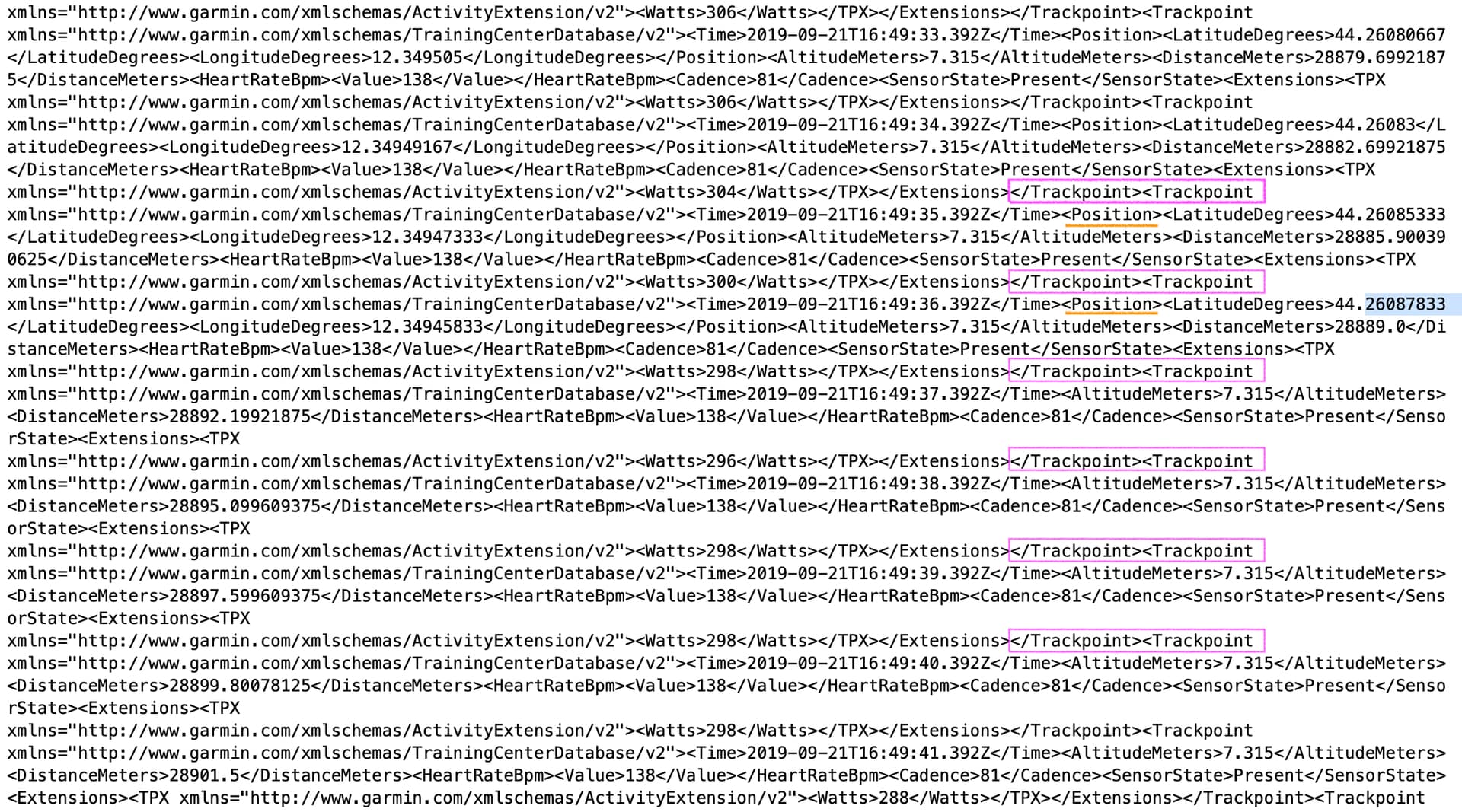
I did some investigation on the tcx file and found the following:
Trackpoints are marked.
Additionally Position is marked.
→ As you can see there are many Trackpoints with no Position. This is potentially the issue.
Today I did three walks, and recorded them using my venerable Polar Ignite. I downloaded each walk in tcx format from Polar Flow. When I imported them into intervals.icu, all three appeared to start at Long 0, Lat 0.
I imported the files into GOTOES and I could see that each file began with a variable number of rows with 0 in the Lat/Long field. I deleted these rows and exported as tcx.
When they were imported into intervals.org, the mapping was sorted.
I’m presuming that when the activity is started, the watch is recording before a GPS fix is acquired, and the watch’s firmware records 0 for each record before a GPS fix.
Presumably a fix would be either to ignore leading rows with 0 in the Lat/Long field, or to delete these.
Robert
Please mail one of those files to [email protected].
Thanks for looking into this. Could you please mail be one of your files before editing with GOTOES. It’s not likely that the real lat/long is going to be exact 0 ever so I am pretty sure I can fix this automatically.
Out, @david  check your inbox.
I’ve sent a file…
Robert
I have fixed this. Points with missing or zero latitude or longitude are left out now. Tx for the files. You can fix existing activities by doing Actions → Reprocess file.
Highly appreciated. Will make Polar users very happy here.
Can confirm the fix works, many thanks David.
Robert