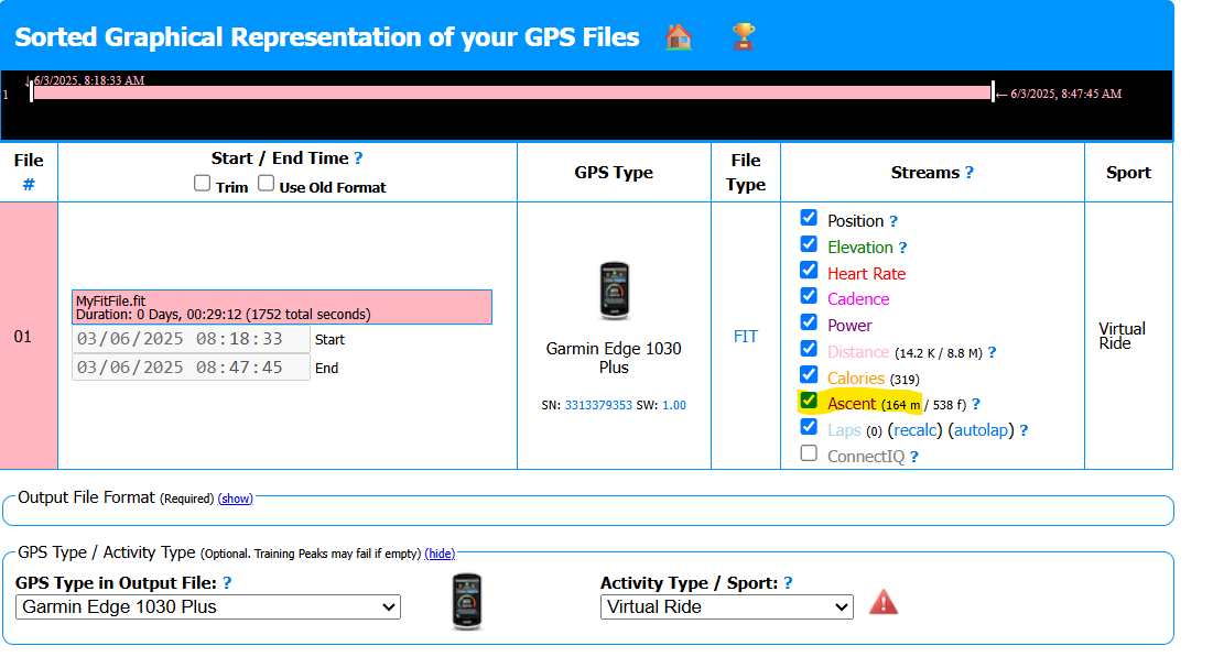
I uploaded a .fit file from my workout to Intervals.icu. The file contains total_ascent = 164 m in the session section (I verified it using FIT File Viewer). However, after uploading, the Climbing value shown in Intervals.icu is only 148 m.
Here’s what I’ve already checked:
Elevation correction is disabled in my Intervals.icu settings.
The file was uploaded directly, not processed through other platforms (e.g., Strava).
The file includes altitude data in the record section, and it looks fairly normal (no major noise).
My question:
Why is the Climbing value shown in Intervals.icu lower than the total_ascent recorded by the device in the .fit file?
Is there some kind of filtering or smoothing algorithm being applied even when elevation correction is turned off?
Did you fiddle with altitude correction at some point? If so, this might explain:
If not, then I’m stumped because AFAIK, if the Altitude gain field in the FIT is populated by your device and altitude correction is disabled, Intervals will initially simply use that and not calculate anything. Once that field get’s overwritten by altitude correction for example, a revert will have Intervals calculate it from the available elevation stream with it’s own algorithm and small differences can show.
I got your file and, well, it’s interesting…
First remark: this is a virtual ride, not a real world ride, which you did not mention.
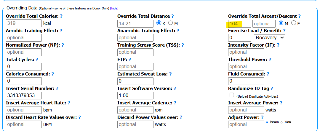
The Total Ascent field value is effectively 164m
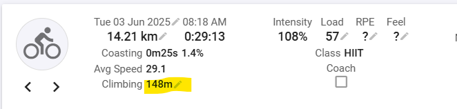
So I would expect Intervals to simply display that. But I have never doublechecked that for a virtual ride. And when I upload your file to my Intervals, it is as you say, 148m.
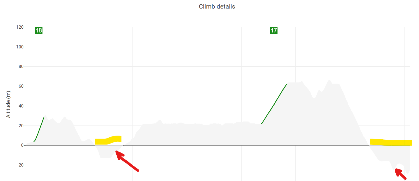
And the difference 164 - 148m = 16m, is almost spot on with the sum of the below 0 climbing parts marked with the red arrow.
What I think is that somehow, Intervals by default, recalculates ascent from the elevation if the source is a virtual ride and discards (wrongly) climbing meters that are recorded below zero.
This is at this moment just an assumption from my side but it does fit the bill. So I would suggest that @david takes a closer look at it.
Question: How did you end up with map and elevation data in your fit file, which shows that it was recorded by a Edge 1030?
If you dual record with a virtual ride app and your Edge, the FIT file from your Edge will not have those normally. So I’m kind of interested in what you are doing to get those streams on your Edge. Many people around here would be interested
Or is this a file from a virtual ride app, that is ‘spoofing’ as if it was recorded by a Garmin device?
The map data is in the middle of the ocean, so I can’t tell which app you used.
This workout is a virtual ride I did in the MyWhoosh app.
Maybe I need to enable the “Use elevation correction” option specifically for MyWhoosh, not just for Garmin?
Or perhaps MyWhoosh should sent the .fit file in a way that makes Intervals.icu recognize it as a virtual workout, so these altitude offsets don’t affect the total ascent value.
That’s my current understanding of what might be going on, but please correct me if I’m missing something!
@MedTechCD Thank you so much for your help, you have been very helpful in sorting out the problem.
I see it too but for some reason the correction is still applied. @david could you help me if this is a bug on the intervals.icu side ?