I’ll try to explain best as I can…
First off: add a chart which has both Altitude and Fixed Altitude.
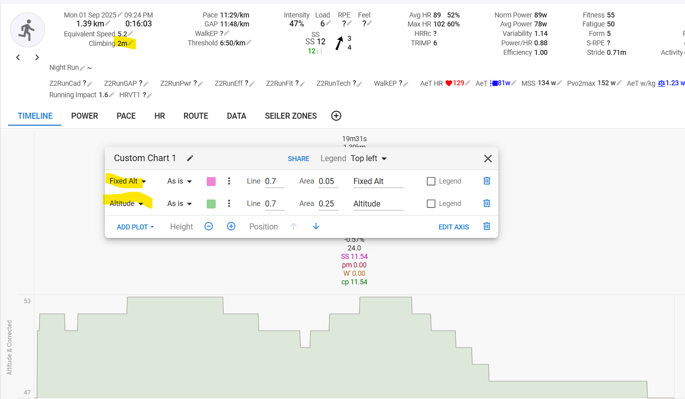
If your settings are to not correct elevation, the above is what you will see at import. Altitude and Fixed Altitude are exactly the same. They just show both the elevation data from the elevation stream in the FIT file. And, this is important to understand the rest, the climbing field in the summary, has the value that was calculated by your device with its own implemented algorithm. That climbing number is written to a FIT field and is what is read by Intervals at import.
Now go to Actions - Settings, enable ‘Elevation correction’ and confirm.
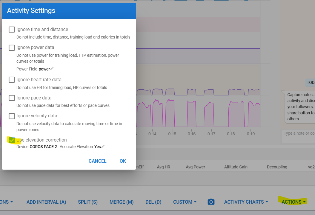
You will see something different:
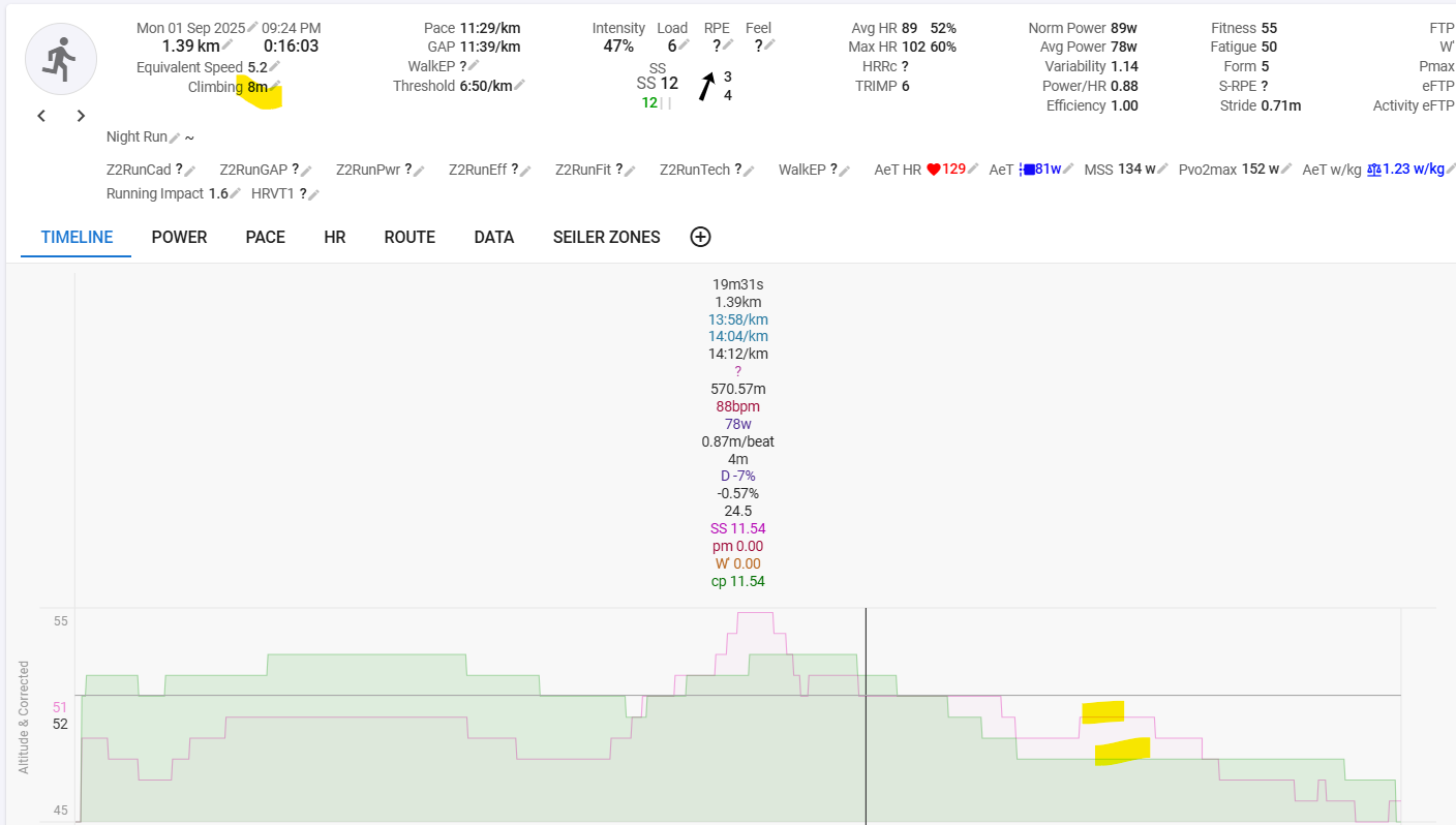
Intervals get’s elevation data for all the recorded LAT/LONG positions from online maps and puts those in a new stream ‘Fixed Altitude’. In the graph, you can see what’s different by comparing both streams. The Climbing field, also has a new number, which is the result of the calculation from Intervals’s algorithm with the fixed altitude stream.
If you don’t like the result, you can deactivate the elevation correction again and you’ll see something like this:
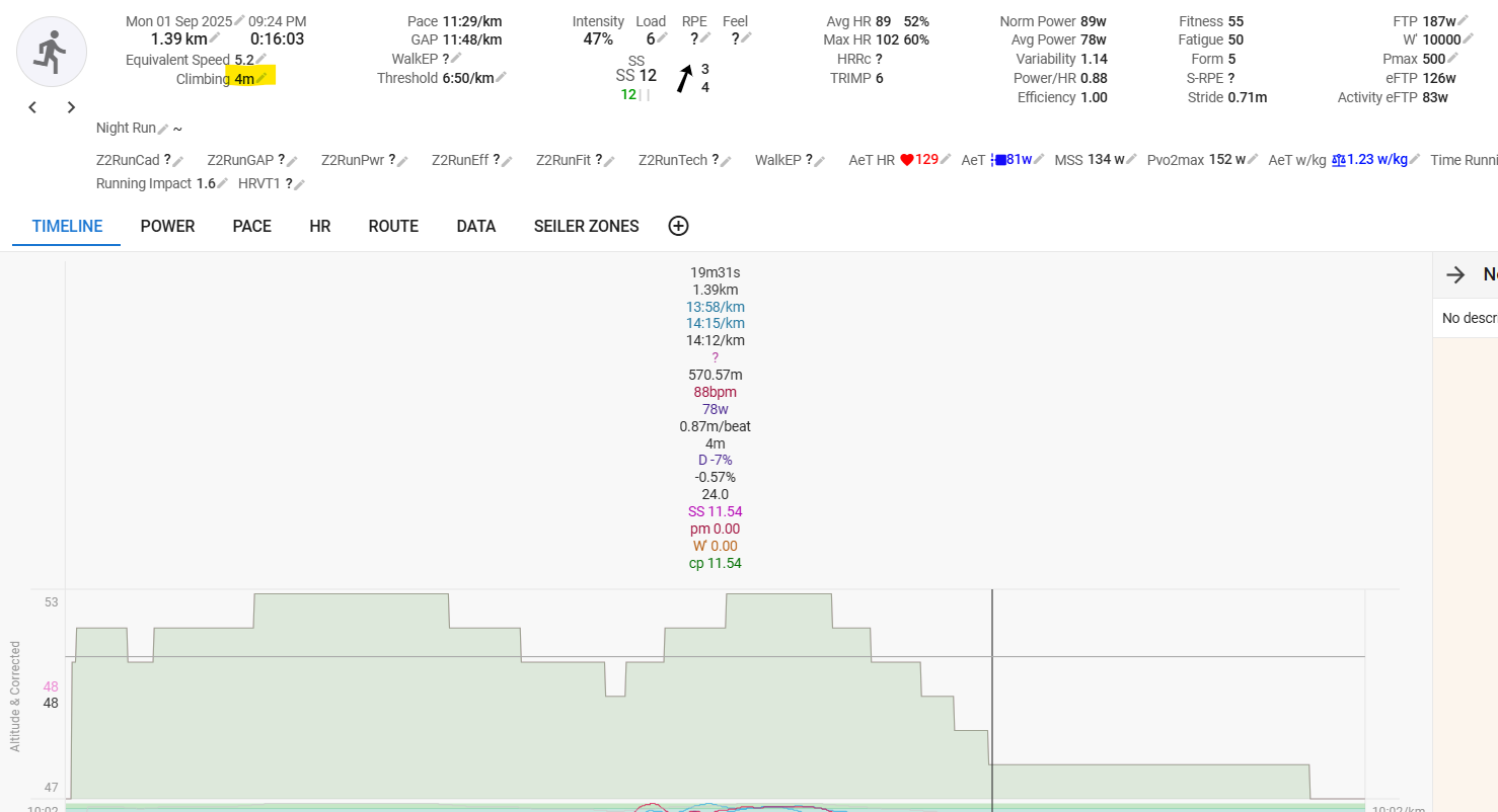
The elevation chart is exactly the same as what you had initially, but chances are high that the Climbing number is not the same. Why? Well, that’s because, in this case, Intervals calculates the climbing from the initial stream with its own algorithm (It can’t access your device’s algorithm). The algorithms for calculating climbing (elevation gained) are different for all manufacturers/software etc. There is a threshold to decide what is a ‘proper’ elevation gain or not and that’s different for each algo. Is 1m up immediately followed by 1m down an elevation gain or not? For some, it is, others ignore that. If that threshold is set to low, you may end up with huge numbers if your barometric sensor keeps oscillating in between 2 values.
If you ‘Reprocess’ the activity, the climbing number calculated by your device will reappear.
All elevation differences you see in between devices and analysis suits, are caused by the different algorithms and, in case of elevation correction, the maps used. If you want some succes with elevation correction, it is extremely important that you have a very good GPS signal. If GPS quality is low, the LAT/LONG points will not be defined correctly and those wonky points can have elevation data that is next to the route you were following. Especially in mountainous terrain with lots of switchbacks, this can result in surprising numbers…